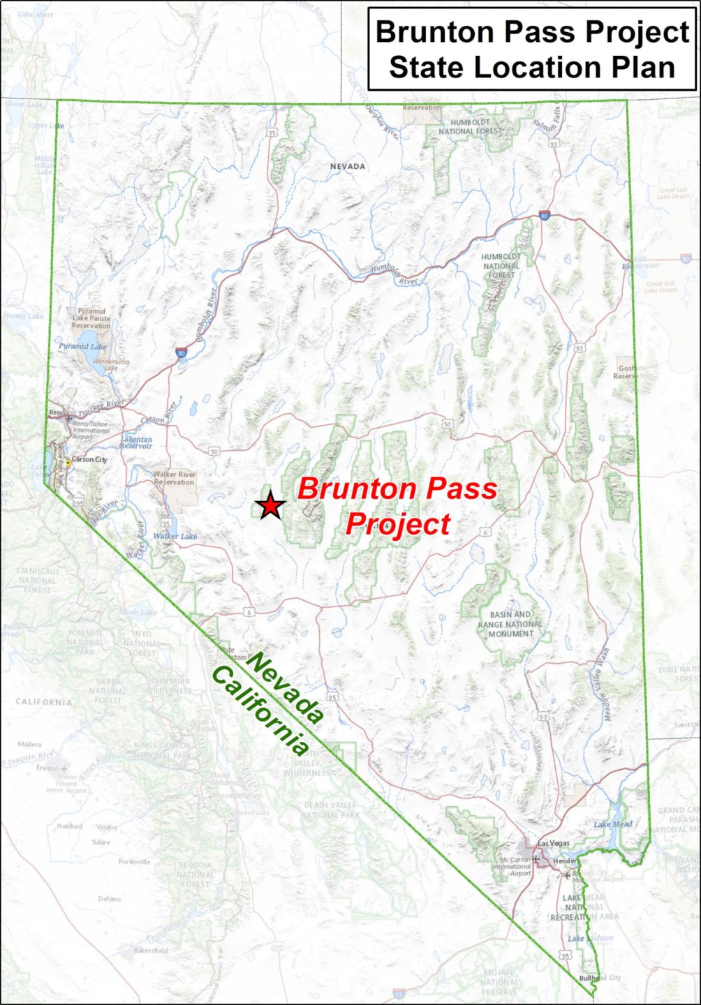
The Brunton Pass Project is located in central Nevada 25km northeast of the high-sulphidation epithermal Paradise Peak gold deposit that produced over 1.6 million ounces of gold and over 44 million ounces of silver and at least 457 tons of mercury.
The project was acquired in 2021 after sampling of prospector small-scale surface workings revealed high copper values. Reconnaissance rock chip sampling and mapping were subsequently carried out throughout the claim block returning values up to 6.84% copper and 1.75 g/t gold in separate samples as well as anomalous silver values.
Mineralisation at Brunton Pass is closely associated with hornfels, skarn and high-sulphidation-style epithermal alteration of a mixed sequence of Triassic aged carbonate and clastic sediments that form a 1.8km x 0.75km, uplifted “window” (horst block) in fault contact within younger Tertiary-age volcanic rocks.
Evidence for an underlying body intrusive is found in surface outcrops of granite/granodiorite and at least two phases of diorite intrusion.
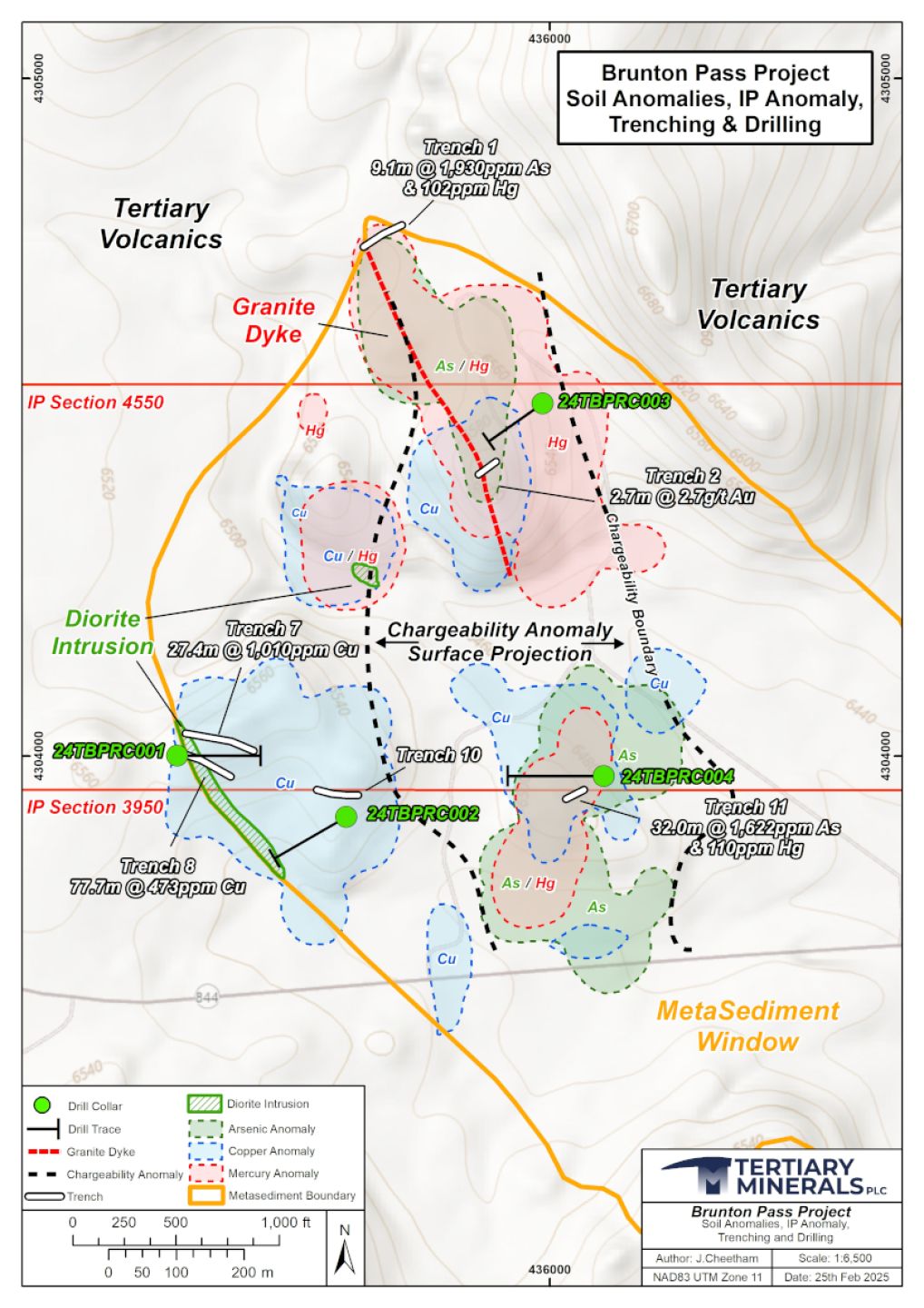
Following initial prospecting a total of 485 soil samples were collected at 50m spacing on lines 100m apart over the main window and on a 100m by 100m offset grid over the remainder of the project area.
Several copper-in-soil anomalies with individual grades of up to 953ppm copper were delineated based on this sampling. The largest of these anomalies in the southwest quadrant of the property has dimensions of 340m x 310m and they are mainly coincident with areas where rock grab samples contain percent-level copper values in small prospecting pits.
Two large mercury and arsenic in soil anomalies were also defined in the eastern half of the property in a north trending zone with values up to 52 ppm mercury with the largest of these extending over an area approximately 500m x 500m. These anomalies are centred on a north trending zone of structural dislocation with a strike length of at least 1.2km entirely within the project area.
In summer 2022, a programme of trenching, sampling, geochemical analysis, petrological evaluation and field follow up was carried out.
A drone magnetic and photogrammetric survey was also carried out in 2021 and the data was subsequently processed using magnetic vector inversion modelling.
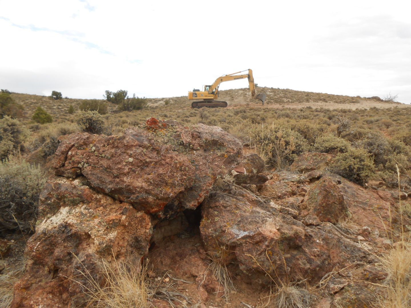
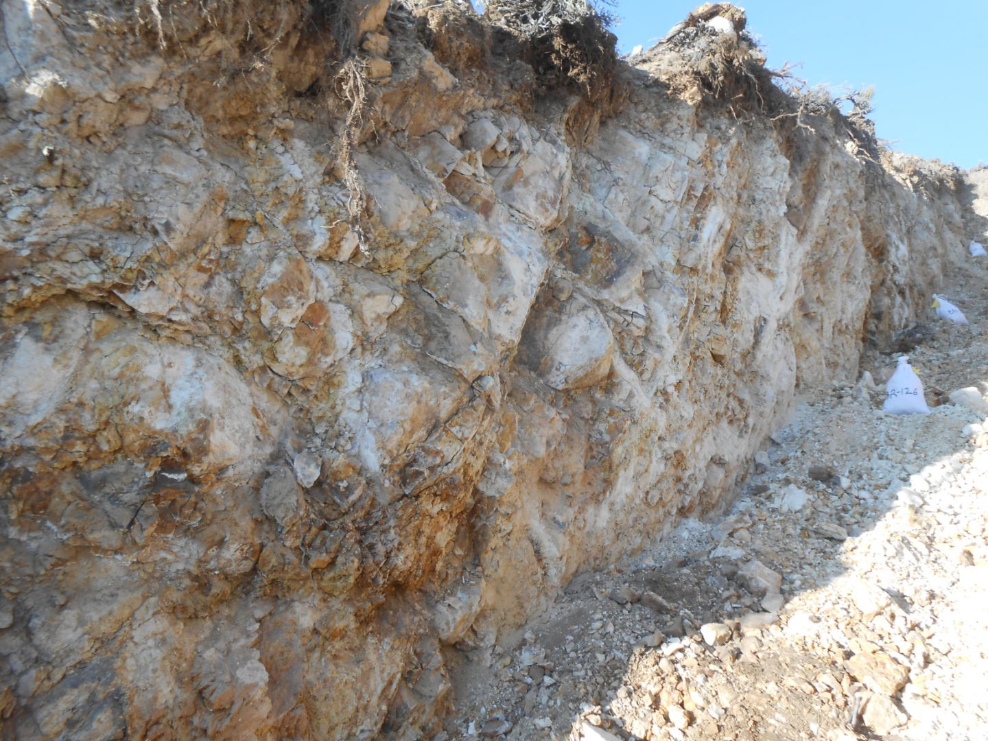
In 2022 six trenches (T1, T2, T7, T8, T10 and T11) were completed for a combined length of 386m to further evaluate previously reported copper, mercury and arsenic anomalies in soil and surface rock chip samples.
Wide intervals of low-grade copper observed in trenches T7 and T8:
Petrological evaluation has confirmed the copper is associated with widespread garnet-pyroxene skarn alteration adjacent to diorite intrusives.
These wide low-grade copper intervals are a possible halo to more significant mineralisation and suggest the possible presence of a deeper porphyry copper target.
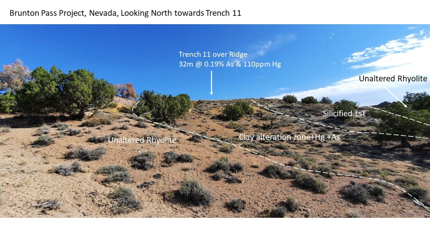
Two trenches (T1 & T11) testing the north and south ends of a 1.2km long zone of mercury-arsenic soil anomalies intersected substantial widths of hydrothermally altered rock with approximately 1,000 times background content of the gold indicator elements, arsenic and mercury:
The argillic alteration evident in T1 and T11 is similar to that seen at the Paradise Peak Gold Mine (smectite+quartz+/-opal). Trench T2, located between T1 and T11, intersected 2.65g/t gold over 2.7m.
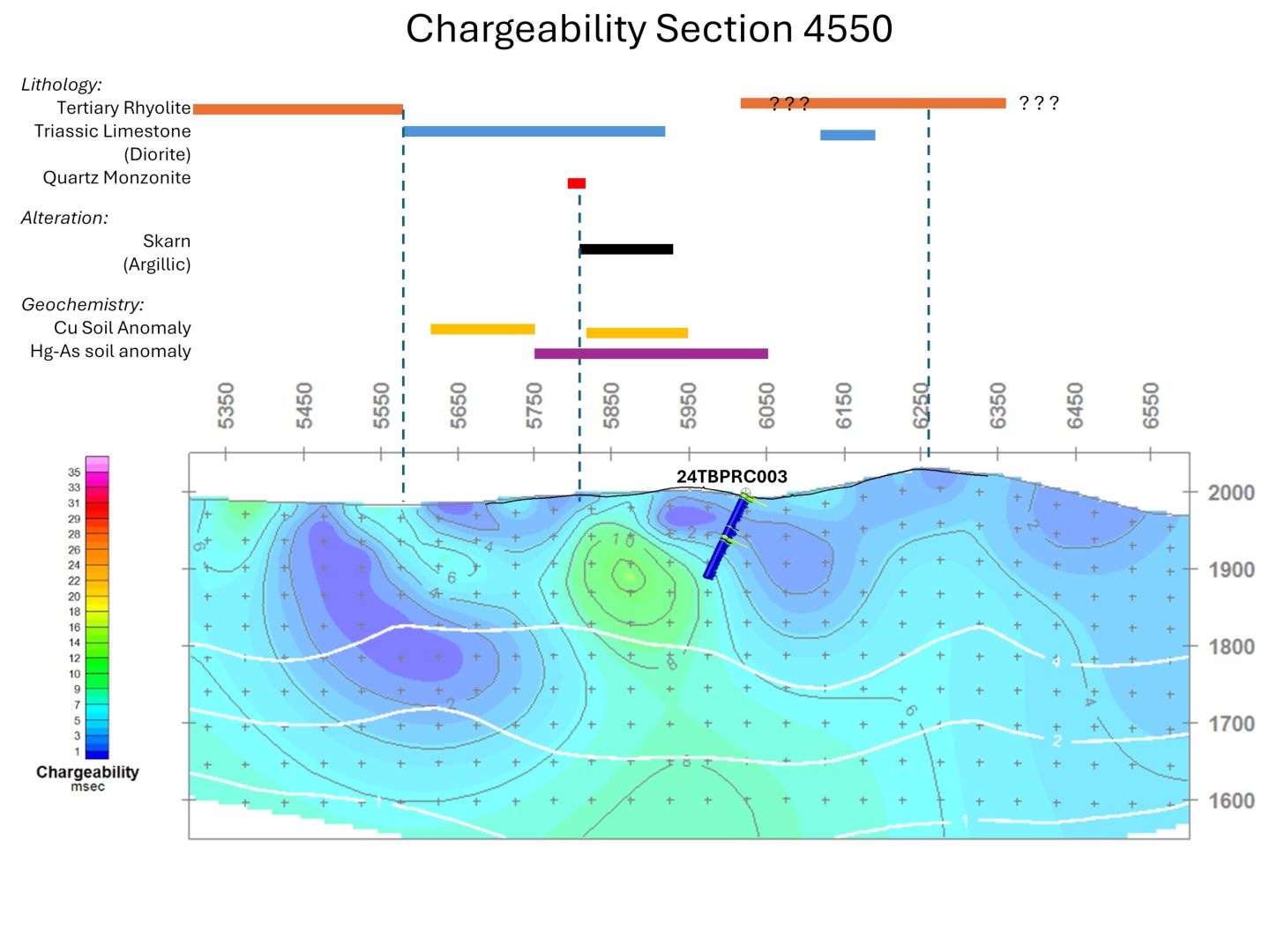
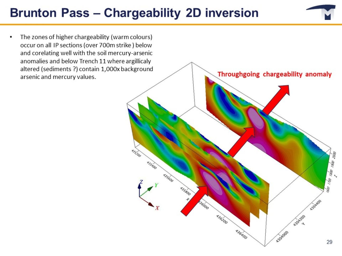
In early 2024, an IP Survey and Resistivity geophysical survey was carried out by Zonge International over 7.2 line-km on four lines over total target strike length of 700m.
2D inversion of the IP and resistivity data has identified a coherent electrical chargeability anomaly, typical of sulphide mineralisation prospective for copper and/or gold, extending over 700m through all IP survey lines.
The chargeability anomaly is spatially related to the previously identified copper-mercury-arsenic soil anomalies, the surface alteration zone in Trench T11 and the gold-bearing zone in Trench T2.
Resistivity variations are conformable with surface geology and help map out subsurface geology.
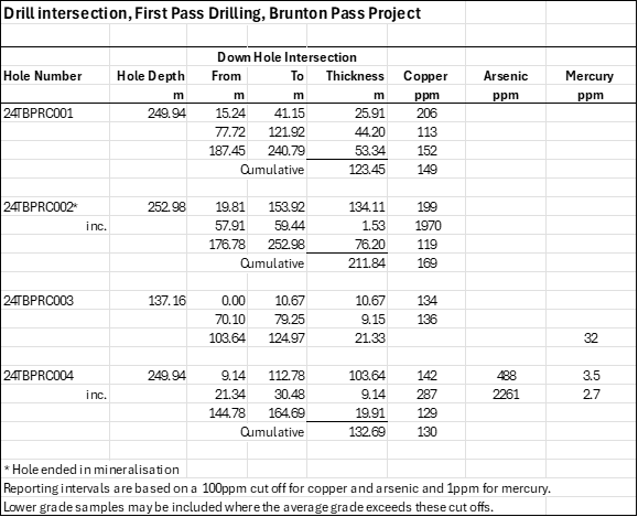
Four reverse circulation percussion drill holes were completed in late 2024 for a total of 890m in first pass drill programme to test beneath the trenches and to test the IP anomalies.
All four holes intersected thick intervals containing anomalous copper values associated with fresh and oxidised pyrite and trace chalcopyrite with cumulative drill thicknesses up to 210m grading 170ppm copper (Hole 24TBPRC002) with values up to 0.19% copper over 1.53m.
Anomalous copper values extend to at least 212m vertical depth, 630m east-west and 560m north-south and surface mercury and arsenic indicator anomalies persist at depth.
Deeper diamond drilling is justified to test the core of the target Induced Polarisation (“IP”) geophysical anomaly. Petrographic and additional geochemical analysis is planned to assist future drill targeting.